|
Henry Howe (1816-1893) Historical Collections of Ohio (Cincinnati, Henry Howe, 1847, 2nd ed 52) |

|
See also: "The Conneaut Witnesses" | 1878 History of Ashtabula Co.
|
HISTORICAL COLLECTIONS OF OHIO; CONTAINING A COLLECTION OF THE MOST INTERESTING FACTS, TRADITIONS, BIOGRAPHICAL SKETCHES, ANECDOTES, ETC. RELATING TO ITS GENERAL AND LOCAL HISTORY: WITH DESCRIPTIONS OF ITS COUNTIES, PRINCIPAL TOWNS AND VILLAGES. ILLUSTRATED BY 1 8 0 E N G R A V I N G S. GIVING VIEWS OF THE CHIEF TOWNS, -- PUBLIC BUILDINGS, -- RELICS OF ANTIQUITY, HISTORIC LOCALITIES, -- NATURAL SCENERY, ETC. BY HENRY HOWE. 
CINCINNATI : PUBLISHED FOR THE AUTHOR BY BRADLEY & ANTHONY. Price three Dollars. 1852. |


|
[ 187 ]
GEAUGA was formed from Trumbull, in 1805, since which its original limits have been much reduced. In March, 1840, the county of Lake was mainly formed from its northern part. The name Geauga, or Sheauga, signifies, in the Indian language, raccoon: it was originally applied to Grand river; thus, "Sheauga sepe," i. e. Raccoon river. The surface is rolling and heavily timbered, and the soil generally clay. The principal exports are sheep, cattle, butter and cheese. The following is a list of its townships, in 1840, with their population.
The population of Geauga, in 1820, was 7791; in 1830, 15,813, and in 1840, 16,299, or 42 inhabitants to a square mile. This county being at the head waters of Chagrin, Cuyahoga and part of Grand rivers, is high ground, and more subject to deep snows than any other part of the Reserve. It was formerly much subject to very high sweeping winds or tornadoes. In August, 1804, John Miner was killed at Chester. He had lately moved from Burton, with part of his family, into a log house which he had built at that place. A furious storm suddenly arose, and the timber commenced falling on all sides, when he directed his two children to go under the floor, and stepped to the door to see the falling timber: at that instant, three trees fell across the house and killed him instantly. The children remained in the house until the next morning. when 188 GEAUGA COUNTY the oldest made her way to a neighbor, about two miles distant, and related the sad tidings.* The first settlement in Geauga, was at Burton, in the year 1798, when three families settled there from Connecticut. This settlement was in the interior of the country, at a considerable distance from any other. The hardships and privations of the early settlers of the Reserve, are well described in the annexed article from the pen of one who was familiar with them. The settlement of the Reserve commenced in a manner somewhat peculiar. Instead of beginning on one side of a county, and progressing gradually into the interior, as had usually been done in similar cases, the proprietors of the Reserve, being governed by different and separate views, began their improvements wherever their individual interests led them. Hence we find many of the first settlers immured in a dense forest, 15 or 20 miles or more from the abode of any white inhabitants. In consequence of their scattered situation, journeys were some times to be performed of 20 or 50 miles, for the sole purpose of having the staple of an ox-yoke mended, or some other mechanical job, in itself trifling, but absolutely essential for the successful prosecution of business. These journeys had to be performed through the wilderness, at a great expense of time, and, in many cases, the only safe guide to direct their course, were the township lines made by the surveyors. The want of mills to grind the first harvests, was in itself a great evil. Prior to the year 1800, many families used a small hand-mill, properly called a sweat-mill, which took the hard labor of two hours to supply flour enough for one person a single day. About the year 1800, one or two grist-mills, operating by water power, were erected. One of these was at Newburg, now in Cuyahoga county. But the distance of many of the settlements from the mills, and the want of roads, often rendered the expense of grinding a single bushel, equal the value of two or three. The difficulties of procuring subsistence for a family, in such circumstances, must be obvious. Few, however, can now fully realize circumstances then very common. Often would a man leave his family in the wilderness with a stinted supply of food, and with his team or pack horse go perhaps some 20 or 30 miles for provision. The necessary appendages of his journey would be an axe, a pocket compass, fire works, and blanket and bells. He cut and beat his way through the woods with his axe, and forded almost impassable streams. When the day was spent, he stopped where he was, fastened his bells to his beasts, and set them at liberty to provide for themselves. Then he would strike a fire, not only to dissipate, in some degree, the gloom and damps of night, but to annoy the gnats and musketoes, and prevent the approach of wolves, bears and panthers. Thus the night passed, with the trees for his shelter. At early dawn, or perhaps long before, he is listening to catch the sound of bells, to him sweet music, for often many hours of tedious wanderings were consumed, ere he could find his team and resume his journey. If prospered, on reaching his place of destination, in obtaining his expected supply, he follows his lonely way back to his anxious and secluded family, and perhaps has scarce time to refresh and rest himself, ere the same journey and errand had to be repeated. CHARDON is 170 miles NE. of Columbus, and 28 from Cleveland. It was laid out about the year 1808, for the county seat, and named from Peter Chardon Brookes, of Boston, then proprietor of the soil. There are but few villages in Ohio, that stand upon such an elevated, commanding ridge as this, and it can be seen in some directions for several miles: although but about 14 miles from Lake Erie, it is computed to be 600 feet above it. The village is scattered and small. In the center is a handsome green, of about eleven acres. on which stands the public buildings, two of which, the court house and Methodist church, are shown in the engraving. The Baptist church and a classical academy, which are on or face the public __________ * Judge Amzi Atwater. GEAUGA COUNTY 189 square, are not shown in this view. Chardon has 6 stores, a newspaper printing office, and in 1840, had 446 inhabitants. Geauga suffered much from the "great drouth," in northern Ohio,
in the summer of 1845, the following brief description of which was communicated to Dr. S. P. Hildreth, by Seabury Ford, Esq., of Geauga, and published in Silliman's Journal. The district of country which suffered the most, was about one hundred miles in length, and fifty or sixty in width; extending nearly east and west parallel with the lake, and in some places directly bordering on the shore of this great inland sea. There was no rain from the last of March, or the 1st of April, until the 10th of June, when there fell a little rain for one day, but no more until the 2d of July, when there probably fell half an inch, as it made the roads a little muddy. From this time, no more rain fell until early in September. This long-continued drouth reduced the streams of water to mere rills, and many springs and wells heretofore unfailing became dry, or nearly so. The grass crop entirely failed, and through several counties the pasture grounds in places were so dry, that in walking across them the dust would rise under the feet, as in highways. So dry was the grass in meadows, that fires, when accidentally kindled, would run over them as over a stubble-field, and great caution was required to prevent damage from them. The crop of oats and corn was nearly destroyed. Many fields of wheat so perished that no attempt was made to harvest them. Scions set in the nursery, dried up for lack of sap in the stocks, and many of the forest trees withered, and all shed their leaves much earlier than usual. The health of the inhabitants was not materially affected, although much sickness was anticipated. Grasshoppers were multiplied exceedingly in many places, and destroyed every green thing that the drouth had spared, even to the thistles and elder tops by the road side. The late frosts and cold drying winds of the spring months, cut off nearly all the fruit, and what few apples remained, were defective at the core, and decayed soon after being gathered in the fall. Many of the farmers sowed fields of turnips in August and September, hoping to raise winter food for their cattle, but the seed generally failed to vegetate for lack of moisture. So great was the scarcity of food for the domestic animals, that early in the autumn large droves of cattle were sent into the valley of the Scioto, where the crops were more abundant, to pass the winter, while others were sent eastward into the borders of Pennsylvania. This region of country abounds in grasses, and one of the staple commodities is the produce of the dairy. Many stocks of dairy cows were broken up and dispersed, selling for only four or five dollars a head, as the cost of wintering would be more than their worth in the spring. Such great losses and suffering from the effects of drouth, has not been experienced in Ohio for many years, if at all since the settlement of the country. As the lands become more completely cleared of the forest trees, dry summers will doubtless be more frequent. In a region so near a large body of water, we 190 GREENE COUNTY should expect more rain than in one at a distance. The sky in that district is, nevertheless, much oftener covered with clouds than in the southern portion of the state, where rains are mnore abundant; but the dividing ridge, or height of land between Lake Erie and the waters of the Ohio, lacks a range of high hills to attract the moisture from the clouds and cause it to descend in showers of rain. Burton, a pleasant village, 8 miles SE. of Chardon, contains 1 Presbyterian, 1 Methodist and 1 Disciples church, an academy, and about 175 inhabitants. Parkman, on a branch of Grand river, and named from Robert B. Parkman, is 16 miles SE. of Chardon, and contains an academy, 1 Methodist and 1 Univeisalist church, 1 flouring, 1 saw and 1 fulling mill, and about 30 dwellings. Three dams are thrown across the river at this place, having unitedly about 60 feet fall, and furnishing much power. There are other small places in the county, at which are post-offices: they are Auburn, Bundysburg, East Claridon, Fowler's Mill, Hamden, Huntsburg, Newburg, Thompson, Welshfield and Chester Cross Roads. At Chester, is the Geauga seminary, under the patronage of the Western Reserve Free-Will Baptist society. This flourishing institution has about 200 pupils, Elder Daniel Branch, A. M., principal.
________
|

|
[ 278 ]
LAKE was formed March 6th, 1840, from Geauga and Cuyahoga, and so named from its bordering on Lake Erie. The surface is more rolling than level; the soil is good, and generally clayey loam, interspersed with ridges of sand and gravel. The principal crops are wheat, corn, oats, barley, buckwheat, hay and potatoes. Dairy products, beef cattle and wool are also among the staples. This county is peculiar for the quality and quantity of its fruit, as apples, pears, peaches, plums, grapes, &c. Many thousand dollars' worth are annually exported, and many of its inhabitants leave every spring, to engage in the business of grafting at the south and west. The situation of this county is very favorable to the preservation of the fruit from the early frosts, the warm lake winds often preventing its destruction, while that some twenty miles inland, is cut off. Bog iron ore is found in large quantities in Perry and Madison, and there are several furnaces in the county. The following is a list of its townships in 1840, with their population:
Population of Lake, in 1840, 13,717, or 65 inhabitants to the square mile. Mentor was the first place settled in this county. In the summer of 1799, two families were there. * Among the earliest settlers of Lake, was the Hon. John Walworth, who was born at New London, Ct., in 1765. When a young man, he spent five years at sea and in Demarara, South America. About the year 1792, he removed, with his family, to the then new country east of Cayuga lake, New York. In 1799, he visited Cleveland, and after his return, in the fall of that year, journeyed to Connecticut, purchased over two thousand acres of land in the present township of Painesville, with the design of making a settlement. On the 20th of February, 1800, he commenced the removal of his family and effects. They were brought on as far as Buffalo, in sleighs. At that place, after some little detention, the party being enlarged by the addition of some others, drove in two sleighs on to the ice of the lake, and proceeded until abreast of Cattaraugus creek, at which point they were about ten miles from land. At dusk, leaving their sleighs and horses some 50 or 60 rods from shore, they made their camp under some hemlock trees, where all, men, women and children passed an agreeable night, its earlier hours being enlivened by good cheer and social converse. The next afternoon, they arrived at Presque isle, (now Erie, Pa.,) where, leaving his family, Mr. Walworth went back to Buffalo, for his goods. On his return to Erie, he, with his hired man and two horses and a yoke of oxen, followed the lake shore, and arrived in safety at his new purchase. His nearest neighbors east, were at Harpersfield, 15 miles distant. On the west, a few miles distant, within or near the present limits of Mentor, was what was then called the Marsh settlement, where was then living Judge Jesse Phelps, Jared Wood, Ebenezer Merry, Charles Parker and Moses Parks. Mr. Walworth soon returned to Erie, on foot, and brought out his family and effects in a flat boat, all arriving safe at the new home on the 7th of April. The first fortnight they lived in a tent, during which period the sun was not seen. About the expiration of this time, Gen. Edward Paine-the first delegate to the legislature from the Lake county, in the winter of 1801-2-arrived with seven or eight hired men, and settled about a mile distant. Mutually assisting each other, cabins were soon erected for shelter, and gradually the conveniences of civilization clustered around them. __________ * Mrs. Tappan, in the MSS. of the Ashtabula Historical Society. ASHTABULA COUNTY 279 Shortly after the formation of the state government, Mr. Walworth, Solomon Griswold, of Windsor, and Calvin Austin, of Warren, were appointed associate judges of Trumbull county. In 1805, Judge Walworth was appointed collector of customs for the district of Erie. In August, he opened the collector's office at Cleveland, and in the March ensuing, removed his family thither. He held various offices until his decease, Sept. 10th, 1812, and was an extensive land agent. Judge Walworth was small in stature, and of weakly constitution. Prior to his removal to the west, it was supposed he had the consumption; but to the hardships and fatigue he endured, and change of climate, his physicians attributed the prolongation of his life many years. He was a fearless man, and possessed of that indomitable perseverance and strength of will, especially important in overcoming the obstacles in the path of the pioneer. *
Painesville, the county seat, and the largest village between Cleveland and Erie, Pa., is 31 miles E. of Cleveland, and 170 NE. of Columbus. The Grand river skirts the village on the east, in a deep and picturesque valley. Painesville is one of the most beautiful villages in the west: it is somewhat scattered, leaving ample room for the cultivation of gardens, ornamental trees and shrubbery. A handsome public square of several acres, adorned with young trees, is laid out near the center of the town, on which face some public buildings and private mansions. The view represents the principal public buildings in the place. The first on the left, is the Methodist church; the building next, without a spire, tower or cupola, is the Disciple church; the one beyond, the Presbyterian church, and that most distant, the court house: these two last front the west side of the public square. Painesville is a flourishing town, containing 1 Episcopal, 1 Presbyterian, 1 Disciples and 1 Methodist church, 14 mercantile stores, 1 flouring mill, 1 bank, 1 newspaper printing office, and has increased since 1840, when it had 1014 inhabitants. The Painesville academy is a classical institution for both sexes, and in fine repute: a large brick building is appropriated for its uses. Near the town is the Geauga furnace, which employs a heavy capital. __________ * From the Barr Mss. 280 ASHTABULA COUNTY Painesville was laid out about the year 1805, by Henry Champion, and originally named Champion: it was afterwards changed to that of the township which derived its name from Gen. Ed. Paine, a native of Connecticut, an officer of the revolution, and an early settler: he died only a few years since, at an advanced age, leaving the reputation of a warm hearted and excellent man. Among the aborigines familiarly known to the early settlers at Painesville, was a fine specimen of manhood, called by the whites, Seneca; by the Indians, Stigwanish, which, being rendered in English, signifies the Standing Stone. Says an old pioneer, in the Barr Mss: Whoever once saw him, and could not at once perceive the dignity of a Roman senator, the honesty of Aristides and the philanthropy of William Penn, must be unacquainted with physiognomy. He was never known to ask a donation, but would accept one exactly as he ought, when offered. But it was not suffered to rest there; an appropriate return was sure to be made, and he would frequently be in advance. He drank cider or Malaga wine moderately, but was so much of a teetotaler, as to have abjured ardent spirits since the time when, in a drunken frenzy, he aimed a blow with his tomahawk at his wife, which split the head of the papoose on her back. He seldom wanted credit in his trading transactions, and when he did, there was no difficulty in obtaining it, as he was sure to make punctual payment in specie. Once, when himself and wife dined with us at Painesville, he took much trouble to instruct her in the use of the knife and fork. Vain attempt! his usual politeness forsook him, and bursts of immoderate laughter succeeded, in which we were all compelled to join. The last time I saw Seneca -- the fine old fellow -- was at Judge Walworth's, in Cleveland, a short time before hostilities commenced with Great Britain. He expressed to me a fear that war was inevitable, and that the Indians, instigated by the British, would overwhelm our weak settlements; but gave the strongest assurances that if it should be possible, he would give us seasonable notice. If he was not prevented by age or infirmities from redeeming his pledge, he was probably killed by his own people, while endeavoring to leave their lines, or by some of ours, through a mistake of his character. The Hon. Samuel Huntington, who was governor of the state from 1808 to 1810, resided at Painesville, in the latter part of his life, and died there in 1817. Prior to his removal to Painesville, he resided at Cleveland. One evening, while travelling towards Cleveland from the east, he was attacked, about two miles from the town, by a pack of wolves, and such was their ferocity, that he broke his umbrella to pieces in keeping them off, to which, and the fleetness of his horse, he owed the preservation of his life. Three miles below Painesville, at the mouth of Grand river, is Fairport, laid out in 1812, by Samuel Huntington, Abraham Skinner, Seymour and Calvin Austin, and Simon Perkins. The first warehouse in this region, and perhaps on the lake, was built about 1803, on the river, two miles above, by Abraham Skinner, near which, in the dwelling of Mr. Skinner, the first court in the old county of Geauga, was held. Fairport has one of the best harbors on the lake, and so well defended from winds, and easy of access, that vessels run in when they cannot easily make other ports. The water is deep enough for any lake craft, and about $60,000 has been expended in improving the harbor, by the general government. Lake steamers stop here, and considerable commerce is carried on. Fairport contains 8 forwarding houses, several groceries, from 20 ASHTABULA COUNTY 281 to 40 dwellings, and a light house, and a beacon to guide the mariner on the fresh water sea. Richmond, one mile above Fairport, on the opposite and west side of the river, was laid out about ten years ago, in the era of speculation. A large village was built, a steamboat was owned there, and great things promised. Not having the natural elements of prosperity, it soon waned, some of its dwellings were removed to Painesville, while many others, deserted and decaying, are left to mark the spot.
The neat and pleasant village of Willoughby, is on Chagrin river, 21 miles from its mouth, 19 miles from Cleveland, and 11 s. w. of Painesville. The village and township were originally called Chagrin, and changed, in 1834, to the present name, in honor of Prof. Willoughby, of Herkimer county, N. Y. It was settled about the year 1799, by David Abbot, (see page 156,) Peter French, Jacob West, Ebenezer Smith, Elisha Graham and others. Abbot built the first grist mill on the site of the Willoughby mills: Smith was the first man who received a regular deed of his land from the Connecticut land company. In 1796, Charles Parker, one of the surveyors, built a house at the mouth of the river, and a number of huts for the use of the land company: the house was the first erected in the township, and probably the first in the county. Parker became a settler in 1802; in 1803 and 1$04, John Miller, Christopher Colson, James Lewis and Jacob West settled in Willoughby. Dr. Henderson, the first regular physician, came in 1813, and the first organized town meeting was held April 3d, 1815. A bloody battle, says tradition, was fought at an early day between the Indians, on the spot where the medical college stands: human bones have been discovered, supposed to be of those who fell in that action. The village of Willoughby contains 4 stores, 2 churches, 18 mechanic shops, 1 fulling mill, and in 1840, had 390 inhabitants. The engraving shows, on the right, the Presbyterian church, on the left, the Methodist church, and in the centre, on a pleasant green, the Medical University, a spacious brick edifice. This flourishing and well conducted institution, was founded in 1834: its number of pupils has 282 ASHTABULA COUNTY been gradually increasing, and in 1846, its annual circular showed 174 students in attendance. The moderate expenses of the institute, the low price of board -- from $1.25 to $1.50 per week -- give it advantages to those of moderate means. Its president is Amasa Trowbridge, who, with seven other professors, and an anatomical demonstrator, form an ample corps of instructors. * Kirtland is 9 miles southwest from Painesville, in a fine country, on an elevation on the southern side of a branch of Chagrin rivers which here runs in a deep and romantic valley, interspersed with dwellings, cultivated farms and woodland. The village, at this time, contains about 250 inhabitants. The Western Reserve Teacher's Seminary, situated here, has 216 pupils of both sexes, is under the charge of Asa D. Lord, with several assistants, and is exerting a beneficial influence upon the cause of education in this region. This village is widely known, from having formerly been the head quarters of the Mormons. While here, in the height of their prosperity, they numbered nearly 3000 persons. On their abandoning it, most of the dwellings went to decay, and it now has somewhat the appearance of a depopulated and broken down place. The view taken, shows the most prominent buildings in the village. In the center, is seen the Mormon Temple; on the right, the Teacher's Seminary, and on the left, on a line with the front of the temple, the old banking house of the Mormons. The temple, the main point of attraction, is 60 by 80 feet, and measures from its base to the top of the spire, 142 feet. It is of rough stone, plastered over, colored blue, and marked to imitate regular courses of masonry. It cost about $40,000. In front, over the large window, is a tablet, bearing the inscription:" House of the Lord, built by the church of the Latter Day Saints, A. D. 1834." The first and second stories are divided into two "grand rooms" for public worship. The attic is partitioned off into about a dozen small apartments. The lower grand room is fitted up with seats as an ordinary church, with canvas curtains hanging from the ceiling, which, on the occasion of prayer meetings, are let down to the tops of the slips, dividing the room into several different apartments, for the use of the separate collections of worshipers. At each end of the room is a set of pulpits, four in number, rising behind each other. Each pulpit is calculated for three persons, so that when they are full, twelve persons occupy each set, or twenty-four persons the two sets. These pulpits were for the officers of the priesthood. The set at the farther end of the room, are for the Melchisedek priesthood, or those who minister in spiritual concerns. The set opposite, near the entrance to the room, are for the Aaronic priesthood, whose duty it is to simply attend to the temporal affairs of the society. These pulpits all bear initials, signifying the rank of their occupants. On the Melchisedek side, are the initials P. E., i e. President of the Elders; M. P. H., President of the High Priests; P. M. H., Pres. of the High Council, and M. P. C., Pres. of the Full Church. On the Aaronic pulpits, are the initials P. D., i. e. President of Deacons; __________ * Removed to Columbus. ASHTABULA COUNTY 283 P. T. A., President of the Teachers; P. A. P., Pres. of the Aaronic Priesthood, and B. P. A., Bishop of the Aaronic Priesthood. The Aaronic priesthood were rarely allowed to preach, that being the especial duty of the higher order, the Melchisedek.
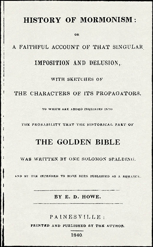
We have received a communication from a resident of Kirtland, dated in the autumn of 1846. It contains some facts of value, and is of interest as coming from an honest man, who has been a subject of the Mormon delusion, but whose faith, we are of opinion, is of late somewhat shaken. The Mormons derive their name from their belief in the book of Mormon, which is said to have been translated from gold plates found in a hill, in Palmyra, N. Y. They came to this place in 1832, and commenced building their temple, which they finished in 1835. When they commenced building the temple, they were few in number, but before they had finished it, they had increased to two thousand. There are in the church two Priesthoods -- the Melchisedek and the Aaronic, including the Levitical, from which they derive their officers. This place, which they hold to be a stake of Zion, was laid off in half acres for a space of one square mile. When it was mostly sold, they bought a number of farms in this vicinity, at a very high price, and were deeply in debt for goods in New York, which were the causes of their eventually leaving for Missouri. They established a bank at Kirtland, from which they issued a number of thousand more dollars than they had specie, which gave their enemies power over them, and those bills became useless. 284 ASHTABULA COUNTY They adhered to their prophet, Smith, in all things, and left here in 1837, seven hundred in one day. They still hold this place to be a stake of Zion, to be eventually a place of gathering. There is a president with his two counselors, to preside over this stake. The president is the highest officer; next is the high priest, below whom are the elders, all of the Melchisedek priesthood. The lesser priesthood are composed of priests, teachers and deacons. They have twelve apostles, whose duty it is to travel and preach the gospel. There are seventy elders or seventies, a number of whom are travelling preachers: seven of the seventies preside over them. There were two seventies organized in Kirtland. They ordain most of the male members to some office. They have a bishop with two counselors, to conduct the affairs of the church in temporal things, and set in judgment upon difficulties which may arise between members; but there is a higher court to which they can appeal, called the high council, which consists of twelve high priests. The president and his council set as judges over either of these courts. There are, how ever, three presidents who preside over the whole in all the world -- so termed. The method of conducting worship among the Mormons is similar to other denominations. The first ordinance is baptism for the remission of sins; they lay on hands for the gift of the Holy Ghost, and to heal the sick; anoint with oil; administer the sacrament; take little children and bless them; they hold to all the gifts of the Apostolic church, believing there is no true church without them, and have the gift of speaking in different tongues; they sometimes interpret for themselves, but commonly there is some one to interpret for them. A prophet has lately risen among the Mormons, viz.: James J. Strang, of Wisconsin, who claims to be the successor of Joseph Smith. He has been with them only about two years, and was a young lawyer of western New York. He claims to have received communications from Heaven, at the very hour of Smith's death, commissioning him to lead the people. He has established a stake in Walworth county, Wisconsin, called the city of Voree, by interpretation, signifying "Garden of Peace;" to which they are gathering, from Nauvoo and other places. He has lately visited Kirtland and re-established it as a stake of Zion, and organized the church with all its officers. There are now here about 100 members, who are daily increasing, and it is thought the place will be built up. Strang is said to have found plates of brass or some other metal. He was directed by an angel, who gave him a stone to look through, by which he made the discovery. They were found three feet under ground, beneath an oak of a foot in diameter. These he has translated: they give an account of a race who once inhabited that land, and became a fallen people. Strang preaches pure bible doctrine, and receives only those who walk humbly before their God. The Mormons still use the temple at Kirtland. This sect is now divided into three factions, viz.: the Rigdonites, the Twelveites, and the Strangites. The Rigdonites are the followers of Sidney Rigdon, and are but a few in number. The Twelveites -- so named after their twelve apostles -- are very fanatical, and hold to the spiritual wife system and the plurality of Gods. The Strangites maintain the original doctrines of Mormonism, and are located at this place and Voree. We derive, from a published source, a brief historical sketch of Mormonism. Joseph Smith, the founder of Mormonism, was born in Sharon, Vermont, Dec. 23d, 1805, and removed to Manchester, Ontario county, N. Y., about the year 1815, at an early age, with his parents, who were in quite humble circumstances. He was occasionally employed in Palmyra as a laborer, and bore the reputation of a lazy and ignorant young man. According to the testimony of respectable individuals in that place, Smith and his father were persons of doubtful moral character, addicted to disreputable habits, and moreover, extremely superstitious, believing in the existence of witchcraft. They at one time procured a mineral rod, and dug in various places for money. Smith testified that when digging he had seen the pot or chest containing the treasure, but never was fortunate enough to get it into his hands. He placed a singular looking stone in his hat, and pretended by the light of it to make many wonderful discoveries of gold, silver and other treasures, deposited in the earth. He commenced his career as the founder of the new sect, when about the age of 18 or 19, and appointed a number of meetings in Palmyra, for the purpose of declaring the divine revelations which he said were made to him. He was, however, unable to produce ASHTABULA COUNTY 285 any excitement in the village; but very few had curiosity sufficient to listen to him. Not having means to print his revelations he applied to Mr. Crane, of the society of Friends, declaring that he was moved by the Spirit to call upon him for assistance. This gentleman bid him go to work, or the state-prison would end his career. Smith had better success with Martin Harris, an industrious and thrifty farmer of Palmyra, who was worth about $10,000, and who became one of his leading disciples. By his assistance, 5,000 copies of the Mormon bible (so called) were published, at an expense of about $3,000. It is possible that Harris might have made the advances with the expectation of a profitable speculation, as a great sale was anticipated. This work is a duodecimo volume containing 590 pages, and is, perhaps, one of the weakest productions ever attempted to be palmed off as a divine revelation. It is mostly a blind mass of words, interwoven with scriptural language and quotations, without much of a leading plan or design. Soon after the publication of the Mormon bible, one Parley P. Pratt, a resident of Lorain county, Ohio, happening to pass through Palmyra, on the canal, and hearing of the new religion, called on the prophet, and was soon converted. Pratt was intimate with Sidney Rigdon, a very popular preacher of the denomination called "Reformers," or "Disciples." About the time of the arrival of Pratt at Manchester, the Smiths were fitting out an expedition for the western country, under the command of Cowdery, in order to convert the Indians, or Lamanites, as they termed them. In October, 1830, this mission, consisting of Cowdery, Pratt, Peterson and Whitmer, arrived at Mentor, Ohio, the residence of Rigdon, well supplied with the new bibles. Near this place, in Kirtland, there were a few families belonging to Rigdon's congregation, who, having become extremely fanatical, were daily looking for some wonderful event to take place in the world: 17 of these persons readily believed in Mormonism, and were all re-immersed in one night by Cowdery. By the conversion of Rigdon soon after, Mormonism received a powerful impetus, and more than 100 converts were speedily added. Rigdon visited Smith at Palmyra, where he tarried about two months, receiving revelations, preaching, &c. He then returned to Kirtland, Ohio, and was followed a few days after by the prophet, Smith, and his connexions. Thus, from a state of almost beggary, the family of Smith were furnished with the "fat of the land" by their disciples, many of whom were wealthy. A Mormon temple was erected at Kirtland, at an expense of about $40,000. In this building there was a sacred apartment, a kind of holy of holies, in which none but the priests were allowed to enter. An unsuccessful application was made to the legislature for the charter of a bank. Upon the refusal, they established an unchartered institution, commenced their banking operations, issued their notes, and made extensive loans. The society now rapidly increased in wealth and numbers, of whom many were doubtless drawn thither by mercenary motives. But the bubble at last burst. The bank being an unchartered institution, the debts due were not legally collectable. With the failure of this institution, the society rapidly declined, and Smith was obliged to leave the state to avoid the sheriff. Most of the sect, with their leader, removed to Missouri, where many outrages were perpetrated against them. The Mormons raised an armed force to "drive off the infidels," but were finally obliged to leave the state. The last stand taken by the Mormons was at Nauvoo, Ill., a beautiful location on the Mississippi river. Here they erected a splendid temple, 120 feet in length by 80 in width, around which they built their city, which at one time contained about 10,000 inhabitants. Being determined to have their own laws and regulations, the difficulties which attended their sojourn in other places followed them here, and there was constant collision between them and the surrounding inhabitants. By some process of law, Joseph Smith (the prophet) and his brother Hyram were confined in the debtor's apartment in the jail at Carthage, in the vicinity of Nauvoo, and a guard of 8 or 10 men were stationed at the jail for their protection. While here, it appears a mob of about 60 men, in disguise, broke through the guard, and firing into the prison, killed both Joseph Smith and brother, Hyram, June 27th, 1844. Their difficulties still continued, and they determined to remove once more. In 1840, a work was published at Painesville, by E. D. Howe, called a "History of Mormonism," which gives almost conclusive evidence that the historical part of the book of Mormons was written by one Solomon Spalding. From this work we derive the following facts. Mr. Spalding was born in Connecticut, in 1761, graduated at Dartmouth, and having failed in mercantile business, removed in 1809 to Conneaut, in the adjoining county of Ashtabula. About the year 286 ASHTABULA COUNTY 1812, his brother, John, visited him at that place. He gives the following testimony: He then told me he had been writing a book, which he intended to have printed, the avails of which he thought would enable him to pay all his debts. The book was entitled the " Manuscript Found," of which he read to me many passages. It was an historical romance of the first settlers of America, endeavoring to show that the American Indians are the descendants of the Jews, or the lost tribes. It gave a detailed account of their journey from Jerusalem, by land and sea, till they arrived in America, under the command of NEPHI and LEHI. They afterwards had quarrels and contentions, and separated into two distinct nations, one of which he denominated Nephites, and the other Lamanites. Cruel and bloody wars ensued, in which great multitudes were slain. They buried their dead in large heaps, which caused the mounds so common in this country. Their arts, sciences and civilization were brought into view, in order to account for all the curious antiquities found in various parts of North and South America. I have recently read the Book of Mormon, and to my great surprise, I find nearly the same historical matter, names, &c., as they were in my brother's writings. I well remember that he wrote in the old style, and commenced about every sentence with "and it came to pass," or "now it came to pass," the same as in the Book of Mormon, and according to the best of my recollection and belief, it is the same as my brother Solomon wrote, with the exception of the religious matter. By what means it has fallen into the hands of Joseph Smith, jr., I am unable to determine. Mr. Henry Lake, of Conneaut, also states: I left the state of New York, late in the year, 1810, and arrived at this place the 1st of January following. Soon after my arrival, I formed a co-partnership with Solomon Spalding, for the purpose of rebuilding a forge which he had commenced a year or two before. He very frequently read to me from a manuscript which he was writing, which he entitled the "Manuscript Found," and which he represented as being found in this town. I spent many hours in hearing him read said writings, and became well acquainted with its contents. He wished me to assist him in getting his production printed, alleging that a book of that kind would meet with a rapid sale. I designed doing so, but the forge not meeting our anticipations, we failed in business, when I declined having any thing to do with the publication of the book. This book represented the American Indians as the descendants of the lost tribes, gave an account of their leaving Jerusalem, their contentions and wars, which were many and great. One time, when he was reading to me the tragic account of Laban, I pointed out to him what I considered an inconsistency, which he promised to correct; but by referring to the Book of Mormon, I find to my surprise that it stands there just as he read it to me then. Some months ago I borrowed the Golden Bible, put it into my pocket, carried it home, and thought no more of it. About a week after, my wife found the book in my coat pocket, as it hung up, and commenced reading it aloud as I lay upon the bed. She had not read twenty minutes till I was astonished to find the same passages in it that Spalding had read to me more than twenty years before, from his" Manuscript Found." Since that, I have more fully examined the said Golden Bible, and have no hesitation in saying that the historical part of it is principally, if not wholly taken from the "Manuscript Found." I well recollect telling Mr. Spalding, that the so frequent use of the words "And it came to pass," " Now it came to pass," rendered it ridiculous. Spalding left here in 1812, and I furnished him means to carry him to Pittsburgh, where he said he would get the book printed, and pay me. But I never heard any more from him or his writings, till I saw them in the Book of Mormon. The testimony of six other witnesses is produced in the work of Mr. Howe, all confirming the main facts as above given. As Mr. Spalding was vain of his writings, and was constantly showing them to his neighbors, reliable testimony to the same general facts might have been greatly multiplied. The disposition Spalding made of his manuscripts is not known. From Conneaut, Spalding removed to Pittsburgh, about the year 1813, remained there a year or two, and from thence went to Amity, in the same state, where he died in 1816. His widow stated that while they resided at Pittsburgh; she thinks that the "Manuscript ASHTABULA COUNTY 287 Found" was once taken to the printing office of Patterson & Lambdin, but did not know whether it was ever returned. We again quote verbatim from the work of Mr. Howe. Having established the fact, therefore, that most of the names and leading incidents contained in the Mormon bible, originated with Solomon Spalding, it is not very material, as we conceive, to show the way and manner by which they fell into the hands of the Smith family. To do this, however, we have made some inquiries. It was inferred at once that some light might be shed upon the subject, and the mystery revealed, by applying to Patterson & Lambdin, in Pittsburgh. But here again death had interposed a barrier. That establishment was dissolved and broken up many years since, and Lambdin died about eight years ago. Mr. Patterson says he has no recollection of any such manuscript being brought there for publication, neither would he have been likely to have seen it, as the business of printing was conducted wholly by Lambdin at that time. He says, however, that many MS. books and pamphlets were brought to the office about that time, which remained upon their shelves for years, without being printed or even examined. Now, as Spalding's book can no where be found, or any thing heard of it after being carried to this establishment, there is the strongest presumption that it remained there in seclusion, till about the year 1823 or'24, at which time Sidney Rigdon located himself in that city. We have been credibly informed that he was on terms of intimacy with Lambdin, being seen frequently in his shop. Rigdon resided in Pittsburgh about three years, and during the whole of that time, as he has since frequently asserted, abandoned preaching and all other employment, for the purpose of studying the bible. He left there, and came into the county where he now resides, about the time Lambdin died, and commenced preaching some new points of doctrine, which were afterwards found to be inculcated in the Mormon bible. He resided in this vicinity about four years previous to the appearance of the book, during which time he made several long visits to Pittsburgh, and perhaps to the Susquehannah, where Smith was then digging for money, or pretending to be translating plates. It may be observed, also, that about the time Rigdon left Pittsburgh, the Smith family began to tell about finding a book that would contain a history of the first inhabitants of America, and that two years elapsed before they finally got possession of it. We are, then, irresistibly led to this conclusion: -- that Lambdin, after having failed in business, had recourse to the old manuscripts then in his possession, in order to raise the wind, by a book speculation, and placed the "Manuscript Found" of Solomon Spalding, in the hands of Rigdon, to be embellished, altered, and added to, as he might think expedient; and three years' study of the bible we should deem little time enough to garble it, as it is transferred to the Mormon book. The former dying, left the latter the sole proprietor, who was obliged to resort to his wits, and in a miraculous way to bring it before the world; for in no other manner could such a book be published without great sacrifice. And where could a more suitable character be found than Jo Smith, whose necromantic fame of arts and of deception, had already extended to a considerable distance? That Lambdin was a person every way qualified and fitted for such an enterprise, we have the testimony of his partner in business, and others of his acquaintance. Add to all these circumstances, the facts, that Rigdon had prepared the minds in a great measure, of nearly a hundred of those who had attended his ministration, to be in readiness to embrace the first mysterious ism that should be presented-the appearance of Cowdery at his residence as soon as the book was printed -- his sudden conversion, after many pretensions to disbelieve it -- his immediately repairing to the residence of Smith, 300 miles distant, where he was forthwith appointed an elder, high priest, and a scribe to the prophet -- the pretended vision that his residence in Ohio was the "promised land," -- the immediate removal of the whole Smith family thither, where they were soon raised from a state of poverty to comparative affluence. We, therefore, must hold out Sidney Rigdon to the world, as being the original "author and proprietor" of the whole Mormon conspiracy, until further light is elicited upon the lost writings of Solomon Spalding. Seven miles southerly from Painesville, is a small and abrupt eminence, of about 200 feet in height, called "Little Mountain." A hotel is kept on the summit, and it commands a beautiful prospect of the adjacent country and Lake Erie, distant 10 miles. It is much visited, and is a favorite resort from the heats of summer. A cool breeze generally blows from the lake, to brace the nerves of the visitor, while around and below, the earth is clothed in beauty. Centerville, 288 LAWRENCE COUNTY 12 miles east of the county seat, has 3 stores, 2 churches, and about 80 dwellings, scattered along the road for about a mile. Two and a half miles E. of the above, on the line of Ashtabula, is Unionville, which contains 4 stores, 2 churches, and about 100 dwellings, scattered along the road.
__________
|


|
Transcriber's Comments
Henry Howe's Historical Collections of Ohio set a benchmark for the study of Mormon history in the Buckeye State, as well as for the Solomon Spalding authorship claims for the Book of Mormon. Howe began researching the content for this, the seventh title in the Barber-Howe series of state histories as early as 1846 and probably a little before that date. As recent "news" in his section on Lake County Howe notes (on page 282) that the Willoughby Medical University has moved its campus to Columbus and includes (on the following page) an excerpt from a letter written during "the autumn of 1846" from "a subject of the Mormon delusion." Howe's was the first history of the State of Ohio to include such details -- and the first to print an illustration of the Mormon Temple at Kirtland, recently claimed by James J. Strang, who "has lately visited Kirtland and re-established it as a stake of Zion..." Although not an eminent work of historical reporting by today's standards, Henry Howe's book set the standard for writings in Ohio history for several decades. It remained in print through several editions, as late as the 1870s and was expanded and re-issued near the end of the century, providing useful material for a whole new generation of readers. It seems that Howe and Barber at least tried to be honest and evenhanded in their reporting, even where they relied heavily upon quotations from disputable sources. Among the latter was Eber D. Howe's 1834 Mormonism Unvailed, which Henry Howe knew from its then recent (1840) second edition as History of Mormonism. Henery Howe's reliance upon the source material from this volume may have been questioned by some readers (especially the Mormons), but by reprinting lengthy quotations regarding the Spalding-Rigdon claims for Mormon origins, he gave those assertions both a wide audience and a new repute for probity. Henry Howe saw no place for the backsliding "Reverend" Solomon Spalding in his section on Ashtabula County and Conneaut township -- Spalding's name is missing entierly from those pages. Where the historian makes mention of Spaldimg's old associates (like Aaron Wright and Nehemiah King) in that section, he says nothing of those persons' allegations that Spalding wrote much of the Book of Mormon. It is only in his pages on Lake County that Henry Howe takes up the subject of Solomon Spalding, as a sort of appendix to his discussion of Mormon Kirtland and Joseph Smith, Jr. Where he does quote from the earlier Howe's book, Henry (no known relation to Eber) reproduces extensive excerpts from the 1833 statements of John Spalding and Henry Lake. The former was a temporary resident of Ohio prior to 1812; the latter was an adopted son of "New Connecticut," who raised a family on her soil before finally moving to Illinois and ending his days there -- just after Howe's Historical Collections of Ohio was first offered for sale. Mr. Lake's old friend, Aaron Wright, survived him by a few years, but by the middle of the nineteenth century most of the "Conneaut Witnesses," whose names Eber D. Howe had first popularized in 1834, were dead and buried. They did not live to see their old allegations spread far and wide by Historical Collections of Ohio. Future historians and encyclopedia writers would follow in Henry Howe's footsteps, granting the "Conneaut Witnesses" and their collective testimony a respected legitimacy well into the first decades of the twentieth century. And, as a matter of fact, those same residents of the Conneaut area were never impeached in their testimony by neighbors and later reporters -- at least not until President James H. Fairchild of Oberlin College began casting aspersion on their character for veracity. Fairchild, who did most of his reporting in 1885 and 1886, lived close enough to the Conneaut area to have conducted interviews with living relatives and old associates of the witnesses, but he never took the trouble to do so. In the decades which followed, when the students of Mormon history compared the declarations of Henry Howe and James H. Fairchild, they increasing chose to believe the latter writer at the expense of the former. Even so, the modern student of the subject should not lose sight of the fact that the collective testimony of the Conneaut witnesses was never controverted by informed persons, either during their lifetimes or for many years thereafter. With popular books like that of Henry Howe spreading their attestation, the public (both Mormon and non-Mormon) had ample opportunity to show and say at least something censorious about these witnesses. Except for the usual Mormon "party line," branding all who challenged Joseph Smith's story as "liars" and "tools of Satan," no such hostile professions were ever recorded against the "Conneaut Witnesses." Among their associates and neighbors, they seem to have sustained their good reputations well after their lives were ended. As a later writer of Ohio history would report, in 1878, they were "all gentlemen of probity." |

Return to Top of Page
Old Spalding Library | New Spalding Library | e-mail Site Host
Mormon Classics | Bookshelf | Newspapers | History Vault
Last Revised: May 16. 27, 2002